Learning How to Learn and Think: Geologic Reasoning Concept Mapping Workshop
Beijing Normal University
September 11-22, 2017
Kip Ault, Ph.D., Professor Emeritus
Lewis & Clark Graduate School of Education and Counseling
Portland, Oregon
USA
www.darwinianwhimsy.com
1. Aims:
Meaningful learning requires making connections among concepts and from concepts to experiences. When structured around core concepts, these connections lead to disciplinary expertise and insight.
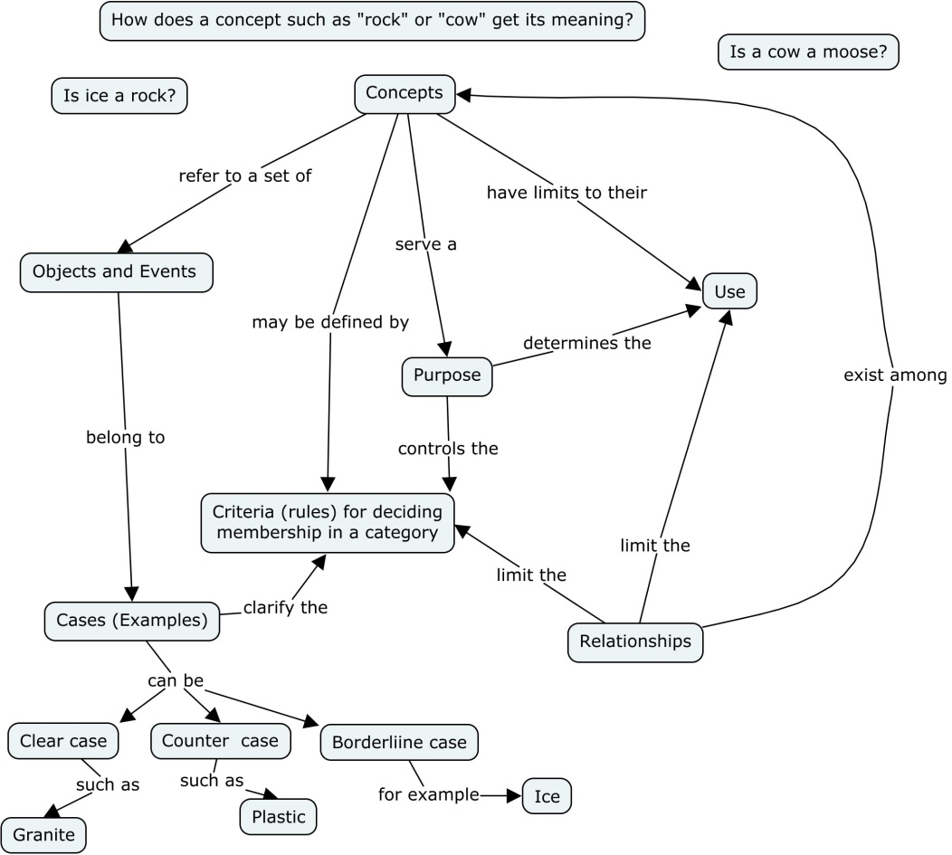
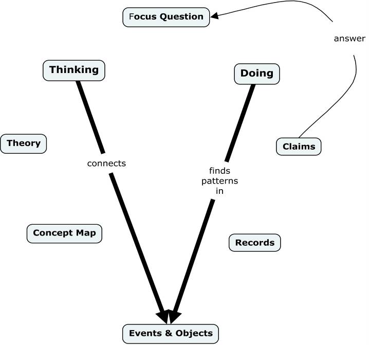
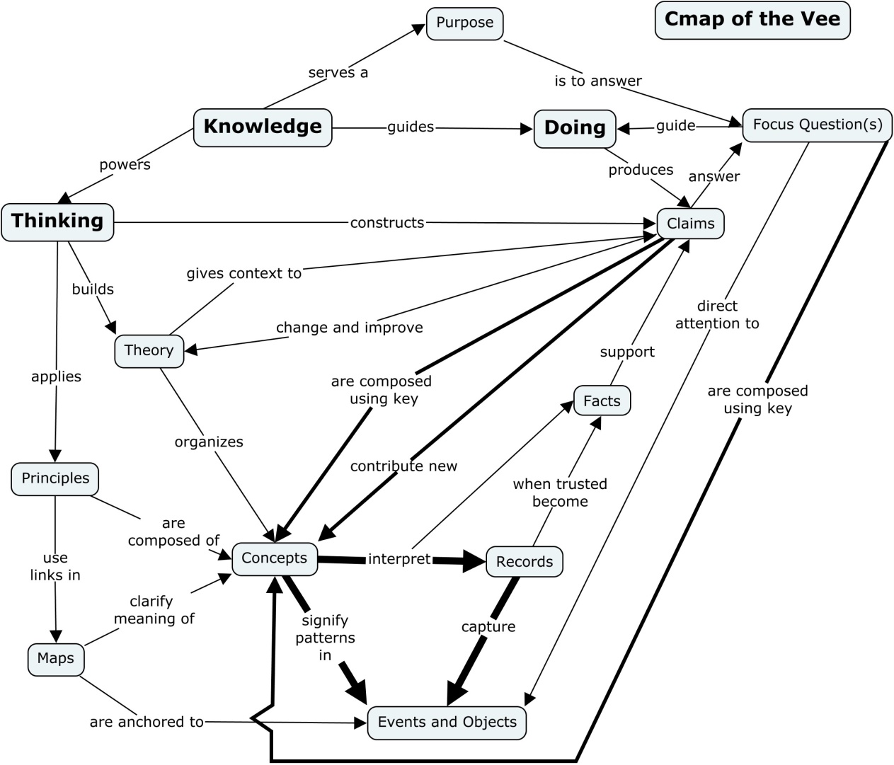
Habits of mind characteristic of different disciplines develop in response to distinct challenges. As a result the structures of knowledge differ from one field to another. Concept mapping and Vee diagramming promise to bring such structures into focus, making learning efficient. (Concept maps are drawings that depict networks of relationships and hierarchy among concepts. Vee diagrams deploy concept maps in order to represent the structure of knowledge in the context of an inquiry.)
Geologic reasoning responds to challenges of scale and the contingent nature of historical phenomena. Often analogical approaches—comparison and contrast—play an important role in geologic inquiry.
Comparing one place to another, in terms of its geologic history and climate pattern, for example, has the potential to illuminate the “big picture” while fostering a “deep love” for knowledge. Geologic inquiry often depends on finding modern analogues for historical processes.
Plate tectonics theory and the geologic time scale are two “big ideas” essential to organizing meaningful understanding of geology. The former can be illustrated with attention to the patterns and processes characteristic of plate boundaries and collisions. The interpretation of the Grand Canyon of the Colorado River reveals the power of insight into deep time. Comparison and contrast of the geologic history of the Tibetan and Colorado Plateaus. understood in terms of plate tectonics, reveals principles for interpreting earth’s dynamic landscapes.
The Earth system—the atmosphere and oceans, the icecaps and glaciers, the soil and vegetation, and the animals and insects—is a complex, interacting system with both strong and delicate feedbacks that govern the climate and the habitability of our planet.
–Ian Roulstone & John Norbury, Invisible in the Storm (Princeton: 2010), pp.44-45
2. Prerequisites:
English proficiency.
Familiarity with geologic or geographic concepts at an introductory level.
Willingness to study original research in an unfamiliar discipline.
Curiosity about how landscapes form.
3. Concept Maps of Concept Meaning and Vee Diagrams (the “big picture”):
4a. Concept Maps of Topics:

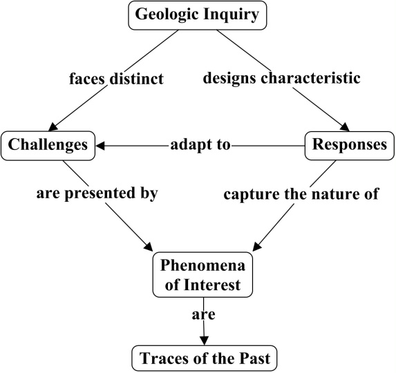
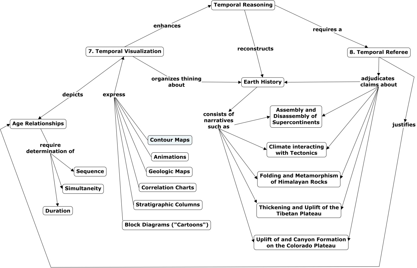
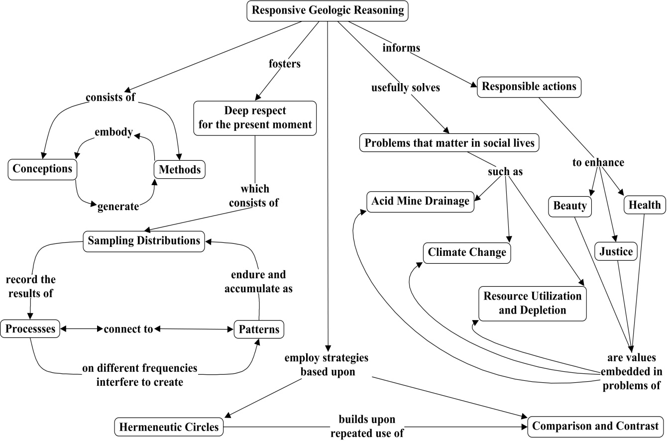
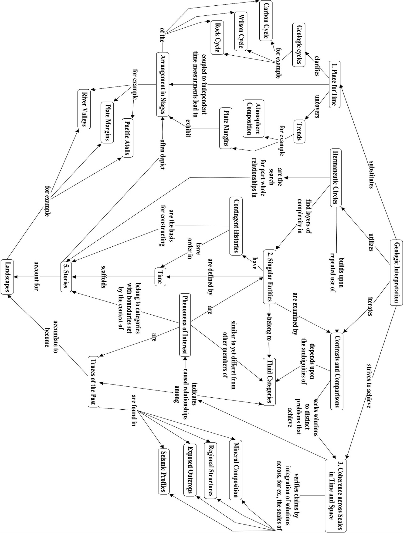
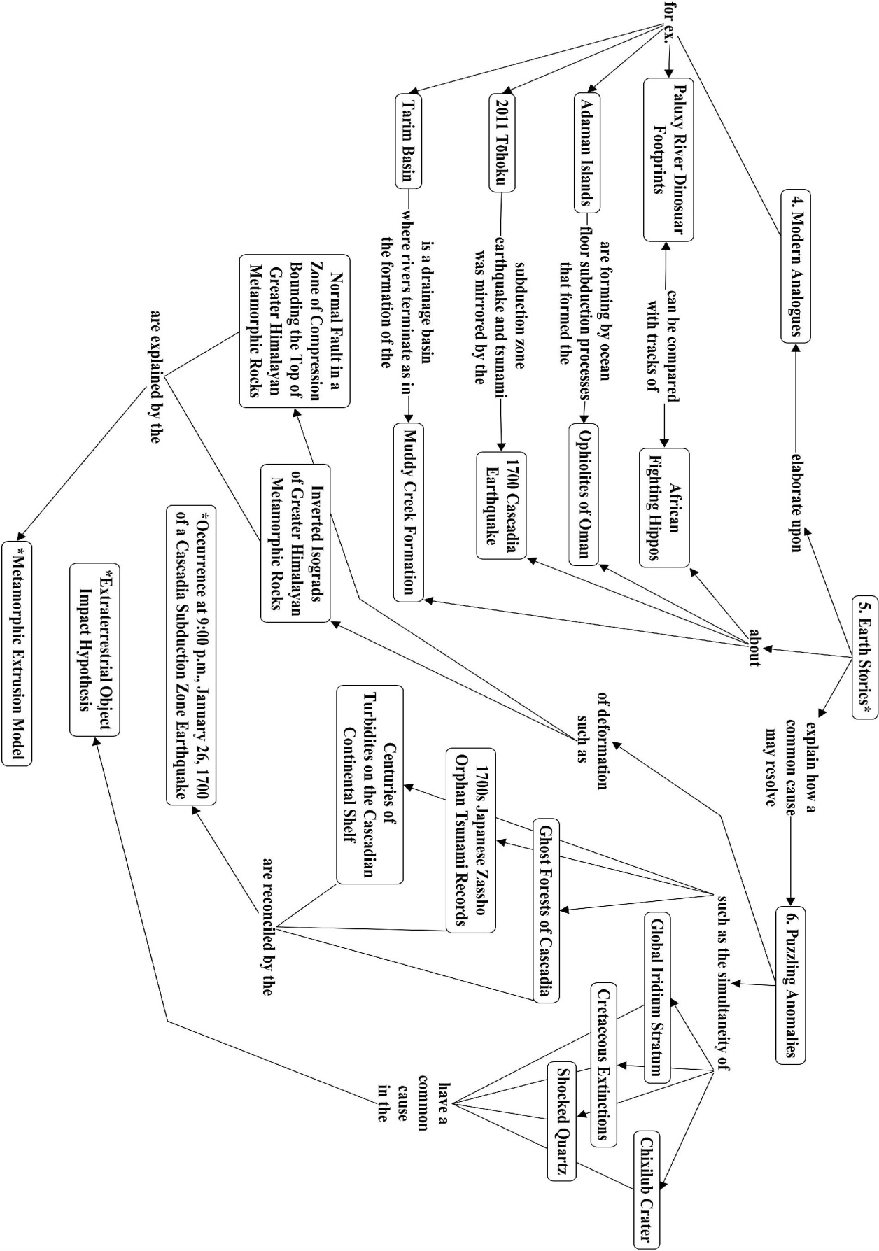
4b Topics:
Concept Maps, Vee Diagrams, and Principles of Geologic Reasoning
Novak, J.D. (1990). Concept mapping and Vee diagrams: Two metacognitive tools to facilitate meaningful learning. Instructional Science, 19, 29-52.
Ault, C. (2015). Gowin’s Knowledge Vee Answers Five Questions about Inquiry. Notes for the BNU Cmap and Vee Diagram Workshop. Unpublished manuscript.
Ault, C. (2017). Thinking Geologic Thoughts: Responding To the Challenges Of Inquiry; 1st Asian Pacific Conference on Concept Mapping, September 20-22, 2017, Beijing Normal University.
Romey, W. D. (1983). Winter Ice and Snow as Models of Igneous Rock Formation. Journal of Geological Education , 31, 9-12.
Patterns of Plate Tectonics
Molnar, Pe. (2015). Plate Tectonics: A Very Short Introduction by Peter Molnar (Oxford, UK: Oxford University Press).
Cascadia Subduction Zone Processes
Ault, C. Review of The Orphan Tsunami of 1700. (2006). Prepared for the University of Washington Press.
Formation of the Grand Canyon of the Colorado River
Pederson, J. L. (2007). The Mystery of the Pre–Grand Canyon Colorado River—Results from the Muddy Creek Formation: GSA Today, v. 183, p. 4-10. doi: 10.1130/GSAT01803A.
Karlstrom, K., et al. (2012). Introduction: CRevolution 2: Origin and evolution of the Colorado River system II. Geosphere, 8, 1170–1176. doi:10.1130/GES00716.1
Lucchita, I., Holm, R.F., & Lucchitta, B.K. (2013). Implications of the Miocene (?) Crooked Ridge River of northern Arizona for the evolution of the Colorado River and Grand Canyon. Geosphere, 9, 1417–1433. doi:10.1130/GES00861.1
Causes and Consequences of Plateau Uplift (Tibet and Colorado)
Fillmore, R. 2011. Geological Evolution of the Colorado Plateau of Eastern Utah and Western Colorado. Salt Lake City, UT: University of Utah Press.
Fillmore, R. (2011), The Tertiary Period: The Rise of the Colorado Plateau, Geological Evolution of the Colorado Plateau of Eastern Utah and Western Colorado. Salt Lake City, UT: University of Utah Press.
Garzione, Carmala N. (2008). Surface uplift of Tibet and Cenozoic Global Cooling. Geology, 36(12), 1003-1004.doi: 10.1130/focus122008.1
Harrison, M.T., Copeland, P., Kidd, W. S. F., & Yin, An. (1991). Raising Tibet, Science 255, 1663-170. See also “A Quake-Causing Collision Course,” New York Times, May 19, 2015, p. D5.
Raymo, M.E., & Ruddiman, W.F. (1992). Tectonic forcing of late Cenozoic Climate. Nature, 359(6391), 117-122.
Ruddiman, W.F., & Kutzbach, J.E. (1991). Plateau Uplift and Climatic Change: The formation of giant plateaus in Tibet and the American West may explain why the earth’s climate has grown markedly cooler and more regionally diverse in the past 40 million years. Scientific American, 264(3), 66-75.
Searle, M. (2013). Roof of the World in Colliding Continents. Oxford, UK: Oxford University Press.
Searle, M. (2013). The Making of the Himalaya/Tibetan Plateau in Colliding Continents. Oxford, UK: Oxford University Press.
4c. Powerpoint resources:
ppt. 001, “Introduction and Analogy.”
ppt. 003, “Colorado Plateau and Plate Tectonics.”
ppt. 002 “Ghost Forests of Cascadia.”
ppt. 005 “Colliding Continents and Plate Driven Tectonics
ppt. 006 “Climate Change and Plateau Uplift
ppt. 009 “Grand Canyon and the Trail of Time
5. Course Arrangement:
- Field Activity
- Interpreting the viewing stones of the BNU campus
- Ice and buoyancy exploration
- The rock cycle as displayed in the lobby of the Jingshi Hotel
- Homework and Classroom Concept Mapping and Vee Diagramming Exercises
- What are the organizing concepts of plate tectonics?
- What caused the “Ghost Forests” near the coast in the Pacific Northwest (Cascadia)?
- How did the Colorado and Tibetan Plateaus form?
- When and how did the Colorado River carve the Grand Canyon?
- How are the weathering and uplift of Tibet related to climate change?
- Apply principles of geologic reasoning to examples of interpreting Cascadia, Tibet, and the Grand Canyon.
6a. Supporting References:
Blakey, Ron, & Ranney, Wayne. 2008. Ancient Landscapes of the Colorado Plateau. Grand Canyon, AZ: Grand Canyon Association.
Kearey, P. Klepeis, K. A., and Vine, F. J. 2009. Global Tectonics. West Sussex: Wiley-Blackwell.
Nie, J., Horton, B. K., and Hoke, G. D., Eds. 2014. Toward an Improved Understanding of Uplift Mechanisms and the Elevation History of the Tibetan Plateau (GSA Special Paper No. 507). Boulder, CO: Geological Society of America.
Searle, M. 2013. Colliding continents: A geological exploration of the Himalaya, Karakoram, and Tibet. Oxford University Press: Oxford, UK.
6b. Projects (3 maps, 1 vee):
1. Concept map: What are the key concepts of plate tectonics?
2. Concept map: How do rocks form?
3a. Concept map: Models of plateau uplift for Tibet and Colorado or
3b. Concept map: Tibetan plateau and climate change
4a. Vee diagram: Carving the Grand Canyon of the Colorado River or
4b. Vee diagram: Creating the Ghost Forest of Cascadia
6c. Expected hours of work:
Daily reading of Plate Tectonics text by Molnar and research articles for each topic (1-2 hours/day).
Concept map construction and revision daily both during the workshop and as homework working with partners (1-3 hours/day plus evening class).